Deir Jarir
Template:Short description Template:Pp-extended Script error: No such module "Settlement short description".Script error: No such module "Infobox".Template:Template otherScript error: No such module "Check for unknown parameters".Script error: No such module "Check for conflicting parameters".Expression error: Unexpected < operator.
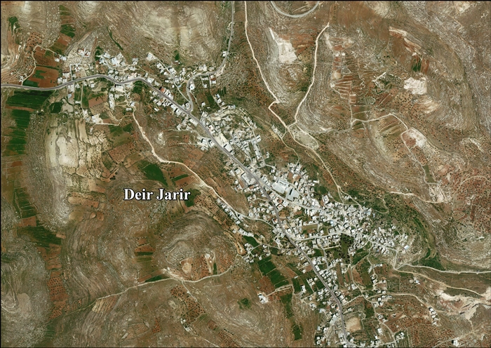
Deir Jarir (Template:Langx) is a Palestinian town in the Ramallah and al-Bireh Governorate of the State of Palestine, in the central West Bank, located Script error: No such module "convert". northeast of Ramallah. It is situated on a hilltop overlooking the Jordan Valley at an elevation of Script error: No such module "convert"..[1] According to the Palestinian Central Bureau of Statistics (PCBS), Deir Jarir had a population of 4,469 inhabitants in 2017.[2]
It spreads across a large land area of Script error: No such module "convert"., of which 17.2% is under the civil jurisdiction of the Palestinian National Authority (PNA) and the remainder under Israeli military control. Most of the land under PNA administration is urban, surrounded by grape vines, and groves of fig and olive trees. 76% of the town's area is open space.[1]
Location
Deir Jarir is located Script error: No such module "convert". northeast of Ramallah. It is bordered by Al Auja to the east, Kafr Malik and Al Mazra'a ash Sharqiya to the north, Silwad to the west, and Et Taiyiba to the south.[3]
Name
The village name means "the monastery/house of Jerir." 19th-century orientalist E. H. Palmer writes that it was named for the Arab poet Jarir ibn Atiyah.[4]
History
Sherds from the Mamluk era have been uncovered.[5] In 1354, income from Deir Jarir was transferred to the waqf in Jerusalem to be used for the upkeep of the Khātūniyya Madrasa. In 1491-1492, annual revenue sent to the madrasa was 3,800 aspers .[6]
Ottoman period
In 1517, Deir Jarir was incorporated into the Ottoman Empire with the rest of Palestine. In 1596 Dar Jarir appeared in the tax registers as being in the nahiya of Quds in the liwa of Quds. It had a population of 23 Muslim households. Taxes were paid on wheat, barley, olives, vineyards, fruit trees, occasional revenues, goats and/or bee hives; a total of 4,300 akçe.[7] Shards from the early Ottoman era have also been found.[5]
In 1838, Deir Jureir was described as a Muslim village in the Beni Murrah region north of Jerusalem.[8][9]
When the French explorer Victor Guérin visited the village in 1863 and 1870, he found 200 inhabitants.[10]
An Ottoman village list dating from 1870 records 111 houses and a population of 394 including men only.[11][12]
In 1882, the PEF's Survey of Western Palestine described Dar Jerir as "a village of moderate size, with ancient tombs to the south, and a spring to the west; a few olives on the same side."[13]
In 1896 the population of Deir Jarir was estimated to be about 828 persons.[14]
British Mandate
In the 1922 census of Palestine, conducted by the British Mandate authorities, the village, named Dair Ijreer, had a population of 739, all Muslim.[15] In the 1931 census the population of Deir Jarir was a total of 847, still entirely Muslim, in 172 inhabited houses.[16]
In the 1945 statistics, the population of Deir Jarir was 1,080, all Muslims,[17] who owned Script error: No such module "convert". of land according to an official land and population survey.[18] 3,091 dunams were plantations and irrigable land, 6,499 used for cereals,[19] while Script error: No such module "convert". were built-up (urban) land.[20]
Jordanian period
In the wake of the 1948 Arab–Israeli War, and after the 1949 Armistice Agreements, Deir Jarir came under Jordanian rule. It was annexed by Jordan in 1950.
The Jordanian census of 1961 found 1,474 inhabitants in Deir Jarir.[21]
1967-present
Since the Six-Day War in 1967, Deir Jarir has been under Israeli occupation. The population of Deir Jerir in the 1967 census conducted by the Israeli authorities was 1,275, 18 of whom originated from the Israeli territory.[22]
After the 1995 accords, 15% of village land was classified as Area B, the remaining 85% as Area C. Israel has confiscated 1,264 of dunams of village land for the construction of the Israeli settlement of Kokhav HaShahar.[23]
In September 2005, hundreds of armed residents from Deir Jarir attacked the nearby town of Taybeh due to a family feud. A Palestinian Christian from Taybeh was accused of having an affair with a Muslim woman from Deir Jarir. 13 houses were burned down and three men were arrested (two from Deir Jarir and one from Taybeh). According to the BBC, however, the towns are still friendly and consider themselves one family".[24]
See also
References
<templatestyles src="Reflist/styles.css" />
- ↑ a b About Deir Jarir village Template:Webarchive The Applied Research Institute - Jerusalem. 2008-03-15.
- ↑ Cite error: Script error: No such module "Namespace detect".Script error: No such module "Namespace detect".
- ↑ Cite error: Script error: No such module "Namespace detect".Script error: No such module "Namespace detect".
- ↑ Cite error: Script error: No such module "Namespace detect".Script error: No such module "Namespace detect".
- ↑ a b Finkelstein et al, 1997, p. 591
- ↑ Burgoyne, 1987, pp. 343−344
- ↑ Hütteroth and Abdulfattah, 1977, p. 113.
- ↑ Robinson and Smith, 1841, vol 2, p. 122
- ↑ Robinson and Smith, 1841, vol 3, Appendix 2, p. 125
- ↑ Guérin, 1869, p. 44, and Guérin, 1874, p. 208
- ↑ Socin, 1879, p. 151 NB: It was noted in the Beni Salim District, a probable typo
- ↑ Hartmann, 1883, p. 115 found 114 houses
- ↑ Conder and Kitchener, 1882, SWP II, p. 291
- ↑ Schick, 1896, p. 122
- ↑ Barron, 1923, Table VII, Sub-district of Ramallah, p. 16
- ↑ Mills, 1932, p. 48
- ↑ Government of Palestine, Department of Statistics, 1945, p. 26
- ↑ Government of Palestine, Department of Statistics. Village Statistics, April, 1945. Quoted in Hadawi, 1970, p. 64
- ↑ Government of Palestine, Department of Statistics. Village Statistics, April, 1945. Quoted in Hadawi, 1970, p. 111
- ↑ Government of Palestine, Department of Statistics. Village Statistics, April, 1945. Quoted in Hadawi, 1970, p. 161
- ↑ Government of Jordan, Department of Statistics, 1964, p. 24
- ↑ Script error: No such module "citation/CS1".
- ↑ Deir Jarir Village Profile, ARIJ, p. 19
- ↑ "A frightening family feud". Williamson, Lucy. BBC News. 2005-09-10.
Script error: No such module "Check for unknown parameters".
Bibliography
<templatestyles src="Refbegin/styles.css" />
- Script error: No such module "citation/CS1".
- Script error: No such module "citation/CS1".
- Script error: No such module "citation/CS1".
- Script error: No such module "citation/CS1".
- Script error: No such module "citation/CS1".
- Script error: No such module "citation/CS1".
- Script error: No such module "citation/CS1".
- Script error: No such module "citation/CS1".
- Script error: No such module "citation/CS1".
- Script error: No such module "Citation/CS1".
- Script error: No such module "citation/CS1".'
- Script error: No such module "citation/CS1".
- Script error: No such module "citation/CS1".
- Script error: No such module "citation/CS1".
- Script error: No such module "citation/CS1".
- Script error: No such module "Citation/CS1".
- Script error: No such module "Citation/CS1".
External links
- Welcome To Dayr Jarir
- Deir Jarir, Welcome to Palestine
- Survey of Western Palestine, Map 14: IAA, Wikimedia commons
- Deir Jarir Village (Fact Sheet), Applied Research Institute–Jerusalem (ARIJ)
- Deir Jarir Village Profile, ARIJ
- Aerial photo, ARIJ
- Locality Development Priorities and Needs in Deir Jarir Village, ARIJ
- Deir Jarir & Silwad: Two Palestinian villages Hammered by the Israeli Occupation 15, March, 2008, POICA
- Ufra Colonists Set Palestinian Fields Ablaze in Deir Jarir- Ramallah Governorate 24, September, 2011, POICA
- Under the guise of legality: Israel's Declaration of State Land in the West Bank, February 2012, B'tselem
Script error: No such module "Navbox". Template:Authority control