Çatalpınar
Jump to navigation
Jump to search
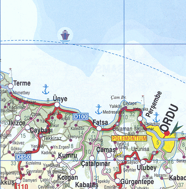
Template:Infobox Turkey place Çatalpınar is a municipality and district of Ordu Province, Turkey.[1] Its area is 101 km2,[2] and its population is 13,025 (2022).[3] The town lies at an elevation of Script error: No such module "convert"..
The local economy depends on agriculture, particularly growing hazelnuts and grazing animals. There is a mineral water spring in the village of Elmaköy.
Composition
There are 23 neighbourhoods in Çatalpınar District:[4]
<templatestyles src="Div col/styles.css"/>
Script error: No such module "Check for unknown parameters".
- Akkaya
- Dere
- Elmaköy
- Göller
- Gündoğdu
- Güney
- Güneyce
- Haşal
- Hatipler
- İncirli
- Karahamza
- Karahasan
- Karşıyaka
- Kayatepe
- Keçili
- Kıran
- Madenköy
- Merkez
- Ortaköy
- Sayacatürk
- Şirinköy
- Terimli
- Yenimahalle
References
<templatestyles src="Reflist/styles.css" />
Script error: No such module "Check for unknown parameters".
External links
- District governor's official website Template:In lang
- Road map of Çatalpınar and environs
- Detailed map of Çatalpınar district
- Various images of Çatalpınar, Ordu
Script error: No such module "Navbox".